 Visitors to Banner Elk can take in all the sights across the NC High Country via a 50-mile driving tour that begins at the stoplight in the center of town.
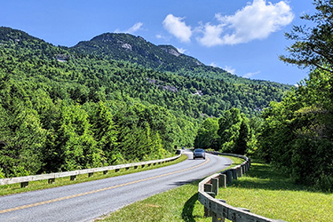
The High Country Road Trip includes one of the most scenic sections of the Blue Ridge Parkway, along with the charming downtowns of Blowing Rock and Boone. In total, the route encompasses more than 500 attractions, hikes, shops, galleries and restaurants.
Longtime favorite attractions include Wilderness Run Alpine Coaster, Grandfather Mountain, Tweetsie Railroad, Mystery Hill, the original Mast General Store and Apple Hill Alpaca Farm. Find something for the entire family to enjoy. Tip: See below for places offering online tickets and reservations.
Download the High Country Road Trip illustrated map and pair it with GPS to create your own itinerary. Explore it in a day or a week.
The guide below offers mile-by-mile highlights as you drive the loop counterclockwise from Banner Elk, which is the quickest route to reach the Blue Ridge Parkway.
High Country Road Trip Driving Tour
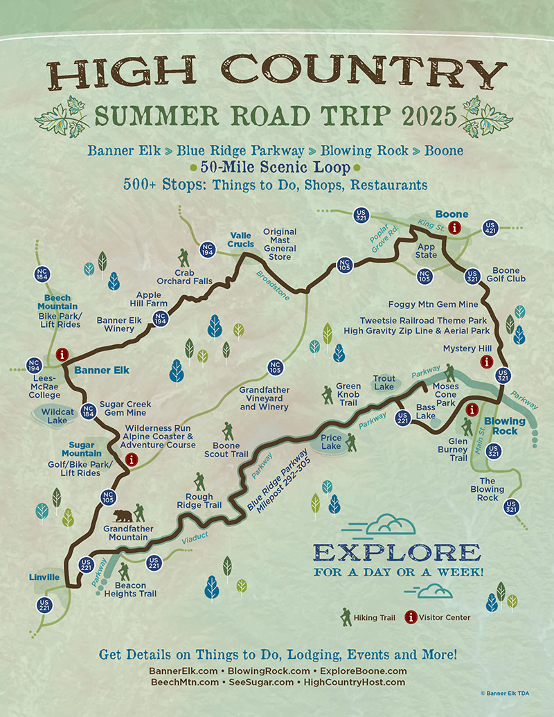
CLICK IMAGE TO ENLARGE
Mile 0.0: Banner Elk Stoplight! Begin your trip on NC 184 South/Shawneehaw Ave South
0.5 Mile: Turn right onto Hickory Nut Gap Road for Banner House Museum & Wildcat Lake Beach
2.7 Miles: Sugar Creek Gem Mine
2.7 Miles: Turn right for Sugar Mountain Public Golf & Tennis and Weekend Scenic Lift Rides & Bike Park (July & Aug) at Sugar Mountain Resort. See the Village of Sugar Mountain Visitor Guide for things to do
2.9 Miles: Wilderness Run Alpine Coaster & Adventure Center, Buy tickets online.
4.2 Miles: Avery County Chamber Visitor Center (4501 Tynecastle Hwy., Banner Elk)
4.2 Miles: Turn right onto NC 105 South
8.1 Miles: Welcome to Linville! Turn left onto U.S. Hwy. 221 North
10.4 Miles: Grandfather Mountain Entrance Gate, Buy tickets online
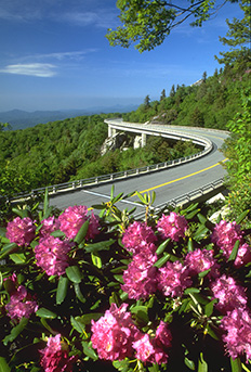
Linn Cove Viaduct on the Blue Ridge Parkway
11.5 Miles: Turn left onto Blue Ridge Parkway entrance ramp. At Parkway, turn right (south) for Beacon Heights Hiking Trail parking area. Turn left to continue the loop north. Milepost 305.2
12.4 Miles: Linn Cove Viaduct rest stop & trail to walk underneath viaduct. Milepost 294.6
13.9 Miles: Rough Ridge Hike – parking area on left. Milepost 302.8
17.3 Miles: Boone Fork Parking Area. Access to Daniel Boone Scout Trail to Grandfather Mountain Summit. Milepost 299.9
20.4 Miles: Price Lake: Hiking, boating, Boone Fork Trail Loop. Milepost 296.7
21.6 Miles: Green Knob Trailhead. Milepost 295.9
23.5 Miles: Moses Cone Park with 25 miles of hiking trails & Manor House with craft shop and info center. Milepost 294.1
Upon leaving Moses Cone Park, go one-half mile south on the Blue Ridge Parkway to exit onto U.S. Hwy. 221 North toward Blowing Rock
24.5 Miles: Bass Pond trail & horseback riding
25 Miles: Turn right on Main Street to explore downtown Blowing Rock. See the Blowing Rock Visitor Guide for things to do. Turn left on Main to continue the loop.
25.5 Miles: Turn left onto U.S. Hwy. 321 / U.S. Hwy. 221 North toward Boone.
25.8 Miles: High Country Host Visitor Center (6370 U.S. Hwy. 321, Blowing Rock)
27.3 Miles: Mystery Hill attraction
28 Miles: Tweetsie Railroad Wild West Theme Park, Buy tickets online
28 Miles: High Gravity Zip Line & Aerial Park
29.8 Miles: Turn right onto Fairway Drive to Boone Golf Club (open to public)
32 Miles: Turn left onto King Street /U.S. Hwy. 421 North. See the Boone Visitor Guide for things to do
32.5 Miles: Downtown Boone: Turn left on Depot Street
32.6 Miles: Turn right on Rivers Street (which becomes Poplar Grove Road)
34.6 Miles: Turn right onto NC 105 South
37.6 Miles: Turn right onto Broadstone Road toward Valle Crucis
40.7 Miles: Original Mast General Store, then go back 2/10 of a mile to intersection to continue loop
40.9 Miles: Turn onto NC 194 South
42.2 Miles: Crab Orchard Falls Trailhead (park at Holy Cross Episcopal Church)
44.6 Miles: Apple Hill Farm – turn right onto Oliver Hill Road for 1.4 miles. Buy tickets online
46.8 Miles: Banner Elk Winery – turn right on Gualtney Road
48.3 Miles: Return to Banner Elk stoplight
In addition, find even more things to do with short side trips, including a winding drive up to Beech Mountain (see the Beech Mountain Visitor Guide).